
Google Maps
Google Maps is undoubtedly one of the most popular and reliable map apps available for the iPad. With its wide range of features and user-friendly interface, it has become the go-to choice for many users. Whether you are navigating through a familiar city or exploring a new destination, Google Maps provides accurate and up-to-date information to ensure you reach your destination efficiently.
One of the standout features of Google Maps is its real-time traffic updates. No one wants to get stuck in traffic, and with Google Maps, you can easily avoid congestion by checking the traffic conditions along your route. You can also view alternative routes to choose the most time-efficient option. The app will even notify you if there are any delays or accidents ahead.
In addition to its traffic updates, Google Maps offers a wealth of information about points of interest. You can search for restaurants, hotels, gas stations, and other places directly within the app. The app provides detailed information, including user reviews, ratings, and photos, to help you make informed decisions about where to go. Whether you are looking for a trendy cafe or a hidden gem, Google Maps has you covered.
Furthermore, Google Maps offers public transportation options, making it an excellent choice for urban dwellers or tourists exploring new cities. You can plan your journey using buses, trains, or subways, and the app will provide you with detailed step-by-step directions to your destination. It even includes real-time updates on transit schedules, ensuring you never miss a connection.
Google Maps also seamlessly integrates with other Google services, such as Google Street View and Google Earth. With Street View, you can explore locations in a 360-degree view, allowing you to virtually walk the streets and get a feel for the area. Google Earth, on the other hand, offers a more immersive experience, allowing you to see satellite imagery and 3D views of various landmarks and locations.
Apple Maps
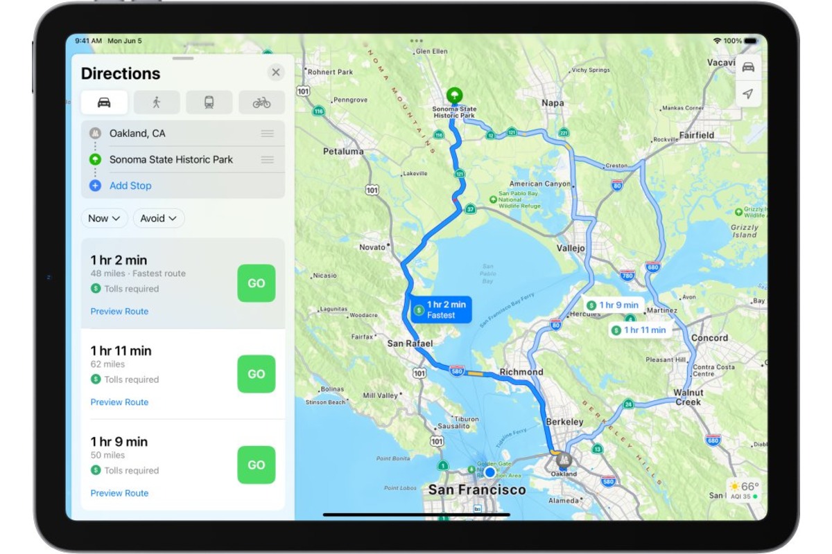
Apple Maps, the default mapping app on iOS devices, has come a long way since its initial release. It is now a viable option for iPad users looking for a reliable and user-friendly map app. With its sleek design and seamless integration with Apple’s ecosystem, Apple Maps offers a seamless navigation experience.
One of the key advantages of Apple Maps is its deep integration with Siri, Apple’s voice assistant. You can simply ask Siri for directions to a destination, and Apple Maps will provide step-by-step navigation. This hands-free approach is especially useful while driving, allowing you to stay focused on the road while receiving verbal instructions.
Apple Maps also provides detailed turn-by-turn directions, making it easy to navigate to your desired location. The app offers real-time traffic updates, which help you avoid congested areas and arrive at your destination on time. It also suggests alternative routes if there are any delays or road closures, ensuring a smooth journey.
One unique feature of Apple Maps is Flyover mode, which allows you to view cities and landmarks in stunning 3D. You can explore major cities, famous landmarks, and even tourist attractions with a virtual tour. This immersive experience adds a new dimension to exploring new places and can be especially valuable for planning your itinerary.
In addition to its navigation features, Apple Maps integrates with other native iOS apps seamlessly. For example, if you receive a message with an address, you can simply tap on the address, and Apple Maps will open with the location preloaded. This integration provides a seamless user experience and saves you time when navigating to unfamiliar places.
While Apple Maps may not have as extensive a database of points of interest as some other map apps, it is steadily improving. You can still find countless restaurants, shops, and landmarks within the app. With user reviews and ratings, you can make informed decisions about where to go and what to do.
Waze
When it comes to real-time traffic updates and community-driven navigation, Waze stands out as one of the best map apps for iPad. Created with a focus on crowd-sourcing data and providing accurate, up-to-the-minute information, Waze offers a unique navigation experience that keeps you informed and helps you navigate efficiently.
One of the standout features of Waze is its active user community. As you drive, Waze collects data from millions of users to provide real-time updates on traffic, road hazards, and even police presence. This crowd-sourced information allows you to avoid accidents, traffic jams, and other road obstacles. You can also contribute to the community by reporting incidents and updating road conditions, ensuring that others benefit from your insights.
Waze goes beyond basic navigation and offers features that enhance the overall driving experience. For example, it provides turn-by-turn voice-guided directions, allowing you to keep your eyes on the road while receiving instructions. The app also includes features such as lane guidance and speed limit warnings, ensuring that you stay on the right track and drive safely.
In addition to its traffic updates, Waze offers integration with popular music streaming services, such as Spotify and Pandora. This allows you to listen to your favorite tunes while navigating, creating a more enjoyable and personalized driving experience. You can control your music directly within the app, without needing to switch between different apps on your iPad.
Waze also offers a feature called “Planned Drives,” where you can input your destination, desired arrival time, and additional preferences. The app will then suggest the optimal time to leave, taking into account traffic conditions and historical data. This feature is especially useful when planning your commute or scheduling a trip, as it helps you avoid peak traffic periods.
Furthermore, Waze provides a social aspect to navigation, allowing you to connect with friends and share your ETA. You can coordinate with others for carpooling or keep track of each other’s progress during a road trip. This adds a sense of community and collaboration to your navigation experience.
Overall, Waze is a powerful map app that offers real-time traffic updates, community-driven data, and various features to enhance your driving experience. If you want to stay informed and navigate efficiently, Waze is definitely worth considering.
MapQuest
MapQuest is a reliable and feature-rich map app for iPad that offers comprehensive navigation capabilities and a user-friendly interface. With its extensive database of maps and points of interest, MapQuest provides a versatile tool for both everyday navigation and trip planning.
One of the standout features of MapQuest is its ability to provide directions for multiple modes of transportation. Whether you are driving, walking, cycling, or using public transportation, MapQuest can generate step-by-step directions tailored to your chosen method. This flexibility is particularly useful for those who prefer to mix and match transportation options or explore a new area on foot.
MapQuest also offers real-time traffic updates, allowing you to plan your routes and avoid delays or congested areas. The app provides alternative routes and gives you the option to avoid toll roads, providing you with options to optimize your journey. You can also view live traffic cameras along your route to get a better understanding of the current traffic conditions.
In addition to its navigation features, MapQuest offers a range of additional tools to enhance your overall experience. For example, it enables you to search for points of interest along your route, such as gas stations, restaurants, and hotels. You can also filter your search results based on specific criteria, such as the type of cuisine or price range for restaurants.
MapQuest also provides the ability to save your favorite locations and create personalized routes. You can save frequently visited places, such as your home or workplace, for quick access. Additionally, you can plan and save multiple routes for future reference, which is useful when organizing a road trip or exploring new destinations.
Another noteworthy feature of MapQuest is its integration with OpenTable and Uber. By linking your OpenTable account, you can easily search for restaurants and make reservations directly within the app. The integration with Uber allows you to request a ride to your destination seamlessly, eliminating the need to switch between different apps.
Overall, MapQuest is a reliable and versatile map app that provides comprehensive navigation capabilities and a range of additional features. Whether you need directions for driving, walking, cycling, or public transportation, MapQuest has you covered, making it an excellent choice for iPad users seeking a robust and user-friendly map app.
HERE WeGo
HERE WeGo is a comprehensive map app for iPad that offers a wealth of features to help you navigate and explore new places with ease. With its detailed maps, offline capabilities, and user-friendly interface, HERE WeGo is a reliable companion for both local and international travel.
One of the standout features of HERE WeGo is its extensive offline functionality. You can download maps of specific regions or entire countries to access them without an internet connection. This is especially useful when traveling abroad or in areas with poor network coverage. Even without an internet connection, you can still search for locations, get driving or walking directions, and view points of interest, ensuring that you never get lost.
HERE WeGo provides turn-by-turn voice-guided directions, allowing for a seamless navigation experience. Whether you are driving or walking, the app will guide you with clear and precise instructions to your desired destination. It also offers real-time traffic updates, enabling you to avoid congestion and plan your route more efficiently.
In addition to its navigation features, HERE WeGo offers public transportation options for numerous cities around the world. You can easily plan your journey using buses, trains, subways, and even ferries. The app provides detailed schedules and route information, ensuring a smooth and hassle-free travel experience.
HERE WeGo also includes a rich database of points of interest, allowing you to discover nearby restaurants, hotels, attractions, and more. The app provides detailed information about these places, including user ratings, reviews, and contact information, helping you make informed decisions about where to go.
Another notable feature of HERE WeGo is its integration with ride-hailing services, such as Uber and Lyft. With just a few taps, you can book a ride directly within the app, providing a convenient and seamless way to reach your destination without having to switch between different applications.
Furthermore, HERE WeGo offers the ability to customize your map view. You can choose different map styles, such as satellite view or terrain view, depending on your preference and needs. The app also allows you to bookmark your favorite locations, making it easy to access them for future reference.
Overall, HERE WeGo is a comprehensive map app that offers offline capabilities, detailed navigation features, and a wide range of points of interest. Whether you are exploring your local area or traveling to new destinations, HERE WeGo provides a reliable and user-friendly experience on your iPad.
CityMaps2Go
If you are looking for a map app that offers detailed offline maps and comprehensive city guides, CityMaps2Go is a top choice for iPad users. With its extensive collection of maps and travel information, CityMaps2Go is a valuable tool for exploring new cities and planning your trips.
One of the standout features of CityMaps2Go is its offline capabilities. You can download maps of specific cities or regions beforehand and access them without an internet connection. This is especially useful when traveling abroad or in areas with limited network coverage. The offline maps are highly detailed and include street names, landmarks, and points of interest, allowing you to navigate with ease.
In addition to its offline maps, CityMaps2Go offers comprehensive city guides that provide valuable information about attractions, restaurants, hotels, and more. You can discover hidden gems, recommended local eateries, and popular tourist spots directly within the app. The guides offer detailed descriptions, user reviews, and even photos, helping you make the most of your visit.
CityMaps2Go also allows you to bookmark your favorite places and create personalized lists. You can save your must-visit attractions, restaurants, and other points of interest for quick access. This feature is particularly handy when planning your itinerary or revisiting places you enjoyed during previous trips.
The app also provides the option to add your own notes and annotations to the maps. Whether you want to mark a specific location, jot down recommendations, or make travel notes, CityMaps2Go gives you the flexibility to customize the maps to suit your needs.
Furthermore, CityMaps2Go offers the ability to share your maps and lists with friends and fellow travelers. You can easily send them your recommendations or collaborate on travel plans by exporting and sharing your customized maps. This makes it convenient to coordinate with travel companions or get advice from others who have visited the same destination.
Another notable feature of CityMaps2Go is its integration with Wikipedia. You can access Wikipedia articles directly from the app to learn more about the history and background of landmarks and attractions. This provides a deeper understanding of the places you are exploring and adds to the overall travel experience.
Overall, CityMaps2Go is a comprehensive map app that offers detailed offline maps, comprehensive city guides, and the ability to customize and share your maps and lists. Whether you are a frequent traveler or simply exploring your own city, CityMaps2Go is a valuable companion on your iPad.
Sygic GPS Navigation & Maps
Sygic GPS Navigation & Maps is a feature-rich map app for iPad that offers a comprehensive navigation experience with its advanced features and user-friendly interface. Whether you are driving, walking, or using public transportation, Sygic provides accurate and reliable directions to help you reach your destination with ease.
One of the standout features of Sygic GPS Navigation & Maps is its offline navigation capabilities. You can download maps for specific regions or entire countries and access them without an internet connection. This is especially useful when traveling internationally or in areas with poor network coverage. The offline maps are highly detailed and offer turn-by-turn voice-guided directions, ensuring that you never get lost even when you are offline.
Sygic also offers real-time traffic updates, allowing you to avoid traffic jams and find the most efficient routes to your destination. The app provides information on traffic congestion, accidents, road closures, and other incidents, helping you make informed decisions about your route. It also offers alternative routes if there are any delays, ensuring that you can reach your destination on time.
In addition to its navigation features, Sygic GPS Navigation & Maps offers an extensive database of points of interest. You can easily search for restaurants, hotels, gas stations, and other places directly within the app. The app provides detailed information, such as user reviews, ratings, and contact details, allowing you to make informed choices about where to eat, sleep, and refuel along your journey.
Another notable feature of Sygic GPS Navigation & Maps is its integration with your car’s infotainment system. The app can connect to compatible car systems via Bluetooth or USB, providing a seamless navigation experience on the car’s display. This integration allows you to control the app’s features using the car’s controls, ensuring a safe and convenient hands-free navigation experience.
Sygic also offers a range of additional features to enhance your navigation experience. For example, it includes speed limit warnings, helping you stay within legal limits and drive safely. The app also offers lane guidance, indicating which lane you should be in for upcoming turns or exits. This feature eliminates the confusion and ensures that you take the correct route.
Furthermore, Sygic GPS Navigation & Maps allows you to plan multi-stop routes and save your favorite places for quick access. You can plan complex itineraries with multiple waypoints and optimize the route for the most efficient journey. The app also provides weather information along your route, allowing you to prepare for the conditions ahead.
Overall, Sygic GPS Navigation & Maps is a comprehensive map app that offers advanced navigation features, offline capabilities, and integration with car systems. Whether you are commuting to work, exploring a new city, or embarking on a road trip, Sygic GPS Navigation & Maps provides a reliable and user-friendly navigation experience on your iPad.
Maps.me
Maps.me is a highly-rated map app for iPad that offers detailed offline maps and a user-friendly interface. With its comprehensive features and reliable navigation capabilities, Maps.me is an excellent choice for travelers and everyday use.
One of the standout features of Maps.me is its extensive offline mapping capabilities. You can download detailed maps of entire countries or specific regions beforehand and access them without an internet connection. This is particularly useful when traveling in remote areas or places with limited network coverage. The offline maps include street names, landmarks, and points of interest, ensuring that you can navigate with confidence even when offline.
In addition to its offline maps, Maps.me offers comprehensive features such as turn-by-turn voice-guided navigation. You can receive precise instructions for driving, walking, and cycling routes. The app also provides real-time traffic updates, allowing you to avoid congestion and find the fastest routes to your destination.
Maps.me boasts a large database of points of interest. Whether you are looking for restaurants, hotels, tourist attractions, or essential services, you can easily search for them within the app. The app provides detailed information, ratings, and user reviews for each location, helping you make informed decisions about where to go and what to do.
One unique feature of Maps.me is its integration with the OpenStreetMap community. OpenStreetMap is a collaborative mapping project, and Maps.me allows users to contribute by adding and editing map data. This community-driven approach helps ensure that the maps stay up-to-date and accurate, benefiting all users.
Maps.me also includes a bookmarking feature, allowing you to save your favorite places and create personalized lists. You can add notes and tags to organize your saved locations, making it easy to plan itineraries or revisit places you enjoyed. The app also supports importing and exporting bookmarks, allowing you to share them with others.
Furthermore, Maps.me offers the ability to estimate walking and cycling times for routes. This feature is particularly helpful when exploring cities on foot or planning bike rides. You can accurately gauge the time needed for your journey and adjust your plans accordingly.
Another notable feature of Maps.me is its integration with public transportation information. You can view public transit routes, stations, and schedules within the app. This provides a convenient way to navigate through cities using buses, trains, or subways.
Scout GPS Navigation & Meet Up
Scout GPS Navigation & Meet Up is a robust map app for iPad that offers a range of features to enhance your navigation and social experience. With its advanced navigation capabilities and built-in Meet Up functionality, Scout GPS Navigation & Meet Up sets itself apart as a comprehensive map app for both solo and group travelers.
One of the standout features of Scout GPS Navigation & Meet Up is its intuitive and user-friendly interface. The app provides turn-by-turn directions with voice guidance, allowing you to navigate effortlessly. The directions are clear and concise, ensuring that you can reach your destination with ease.
Scout GPS Navigation & Meet Up also offers real-time traffic updates, helping you avoid congestion and find the fastest routes. The app provides alternative routes if there are any delays, allowing for a more efficient journey. It also alerts you about accidents, road closures, and other incidents along your route, keeping you informed and allowing for strategic planning.
In addition to its navigation features, Scout GPS Navigation & Meet Up includes the Meet Up functionality, making it easier to plan and coordinate with friends or travel companions. You can create meet-up points and invite others to join. The app allows for real-time location sharing, ensuring that you can easily connect and reunite with your group, even in unfamiliar places.
Scout GPS Navigation & Meet Up also offers integration with popular navigation services such as Uber and Lyft. With just a few taps, you can book a ride directly within the app, eliminating the need to switch between different applications. This integration adds convenience and flexibility to your transportation options.
Another noteworthy feature of Scout GPS Navigation & Meet Up is its efficient search functionality. You can search for various points of interest, such as restaurants, gas stations, and hotels, within the app. The app provides comprehensive details, including user reviews, ratings, and contact information, making it easy to find the best options along your route.
Scout GPS Navigation & Meet Up also includes the ability to save and track your favorite places. You can create personalized lists and bookmark locations for quick access. This feature is particularly useful for planning future trips or keeping a list of places you want to visit.
Furthermore, Scout GPS Navigation & Meet Up offers a feature called “My ETA,” which allows you to share your estimated time of arrival with friends and family. This feature ensures that you can keep others informed about your progress and arrival time, adding an element of safety and organization to your journeys.
Overall, Scout GPS Navigation & Meet Up is a comprehensive map app that offers advanced navigation features and the ability to coordinate with friends. Whether you are exploring solo or traveling in a group, Scout GPS Navigation & Meet Up is a reliable companion for your iPad.
Komoot
Komoot is a unique map app for iPad that caters specifically to outdoor enthusiasts and adventure seekers. With its focus on hiking, biking, and other outdoor activities, Komoot offers a comprehensive and specialized mapping experience for those looking to explore the great outdoors.
One of the standout features of Komoot is its extensive collection of outdoor-specific maps. The app offers detailed topographic maps, specially designed for hiking, biking, and other outdoor activities. These maps provide essential information such as elevation, trail difficulty, and points of interest, ensuring that you have all the necessary information for a successful adventure.
Komoot also offers a planning feature that allows you to create custom routes tailored to your specific activity and preferences. You can choose your starting point, set waypoints, and select the type of terrain you prefer. The app will then generate a personalized route based on your inputs, taking into account factors such as elevation and trail conditions.
In addition to its planning capabilities, Komoot provides turn-by-turn voice-guided navigation for your outdoor activities. This feature ensures that you stay on track and never miss a turn, even in remote areas. The app also offers offline capabilities, allowing you to download maps and routes beforehand and access them without an internet connection.
One unique aspect of Komoot is its community-driven approach. The app allows users to contribute to the mapping data by sharing their own routes, photos, and recommendations. This community aspect adds value to the app, as you can benefit from the experiences and insights of fellow outdoor enthusiasts.
Komoot also includes a wide range of outdoor-specific points of interest. You can easily find nearby campsites, scenic viewpoints, mountain huts, and other attractions. The app provides detailed information and user reviews for each point of interest, ensuring that you can make informed decisions about where to stop and what to explore.
Another noteworthy feature of Komoot is its ability to integrate with compatible fitness tracking devices and apps. You can sync your activities and track your progress directly within the app, allowing you to monitor your performance and gain insights into your outdoor adventures.
Furthermore, Komoot offers the ability to save completed routes and share them with others. This feature is particularly useful for documenting your adventures or inspiring fellow outdoor enthusiasts. You can create a logbook of your activities and refer back to them for future reference or inspiration.
Overall, Komoot is a specialized and comprehensive map app that caters to the needs of outdoor enthusiasts. Whether you enjoy hiking, biking, or any other outdoor activity, Komoot provides the tools and features to plan, navigate, and explore the great outdoors on your iPad.