
What are GPS Coordinates?
GPS coordinates, also known as geographic coordinates, are a set of numerical values that pinpoint a specific location on the Earth’s surface. They are determined using a global navigation satellite system (GNSS), such as the Global Positioning System (GPS). GPS coordinates consist of latitude and longitude values, which represent the distance, in degrees, north or south of the equator (latitude), and east or west of the prime meridian (longitude), respectively.
Latitude is measured in degrees, with values ranging from 0° at the equator to 90° at the North and South Poles. A positive value indicates a location in the northern hemisphere, while a negative value signifies a location in the southern hemisphere.
Longitude is also measured in degrees, ranging from 0° at the prime meridian (located in Greenwich, London) to 180° at the International Date Line in the Pacific Ocean. Positive values are assigned to locations east of the prime meridian, and negative values are assigned to locations west of it.
Combining latitude and longitude values gives you the exact GPS coordinates for a particular spot on the Earth’s surface. For example, the coordinates 40.7128° N, 74.0060° W represent the latitude and longitude of New York City.
GPS coordinates are essential for various applications, including navigation, outdoor activities, geocaching, surveying, and emergency services. They provide precise location information, allowing individuals to determine their position accurately and share it with others.
How to Get GPS Coordinates
Getting GPS coordinates for a specific location can be done using various methods. Here are a few common ways to obtain GPS coordinates:
- Using a GPS Device: Dedicated GPS devices, such as handheld GPS units or GPS-enabled smartwatches, allow you to easily acquire GPS coordinates. Simply turn on the device, wait for it to establish a satellite connection, and navigate to the location you want the coordinates for.
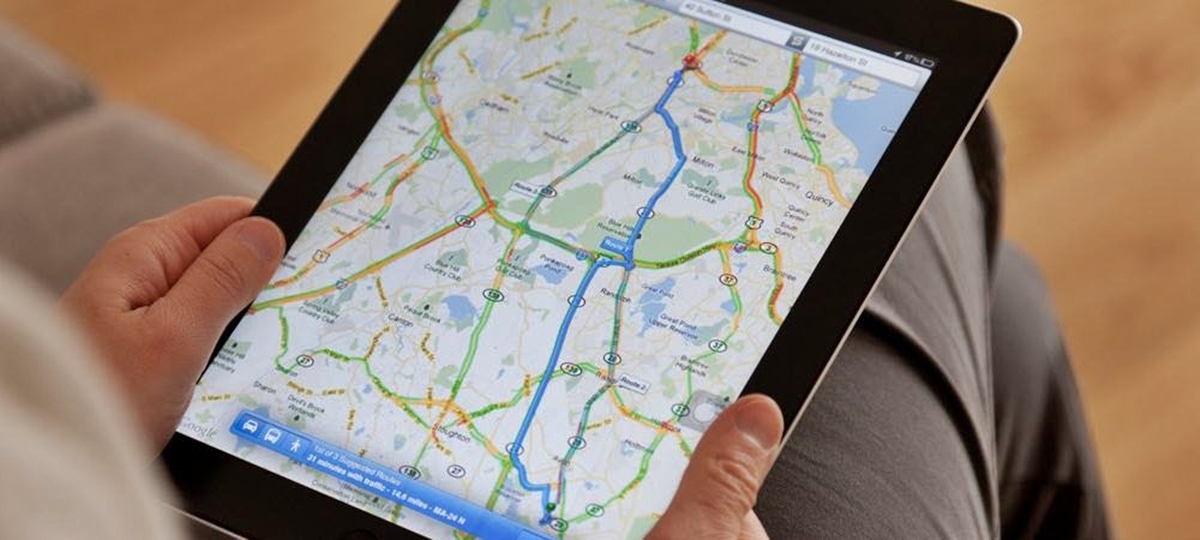
- Using a Smartphone: Most smartphones today come with built-in GPS functionality. You can use GPS-enabled apps like Google Maps or Apple Maps to find the GPS coordinates of a specific location. Open the app, search for the desired location, and tap and hold on the map to get the coordinates.
- Using an Online Map Service: Many online map services, like Google Maps and Bing Maps, provide the option to view and obtain GPS coordinates. Simply search for the location on the map, and the coordinates will be displayed either in the search results or by right-clicking on the map.
- Using a GPS Tracking App: There are various GPS tracking apps available for smartphones that allow you to track your location and display the coordinates. These apps often have additional features such as sharing your location with others or saving favorite locations.
Once you have obtained the GPS coordinates, they can be used for a variety of purposes, such as navigation, geocaching, surveying, or emergency services. These coordinates provide precise location information, ensuring accuracy in whatever activity or application you require them for.
Using a GPS Device
A GPS device is a dedicated tool specifically designed for navigation and tracking purposes. Here is a step-by-step guide on how to use a GPS device to obtain GPS coordinates:
- Power on the GPS device: Turn on your GPS device by pressing the power button. Some devices may require a few moments to acquire a satellite signal.
- Access the GPS menu: Navigate the device’s menu to find the GPS settings or navigation options.
- Select the desired location: Use the device’s navigation features (typically involving buttons or a touch screen) to select and navigate to the desired location for which you want to obtain GPS coordinates. This can be done by entering an address, coordinates, or selecting a point on the map interface.
- View the coordinates: Once the device has calculated your position, it will display the GPS coordinates on the screen. These are typically shown in degrees, minutes, and seconds format or decimal degrees.
- Record or save the coordinates: Depending on the device, you may have the option to record or save the GPS coordinates for future reference. Consult the device’s user manual for specific instructions on how to save coordinates.
Using a GPS device provides a reliable and accurate way to obtain GPS coordinates. They are especially useful for outdoor activities such as hiking, camping, or geocaching, where a dedicated device can offer robust navigation features and long battery life.
Remember to familiarize yourself with the particular features and functions of your GPS device to ensure you can effectively utilize its capabilities and obtain accurate GPS coordinates for any location you desire.
Using a Smartphone
In today’s digital age, smartphones have become powerful tools that offer built-in GPS functionality. Here are the steps to use a smartphone to obtain GPS coordinates:
- Enable Location Services: Go to the settings of your smartphone and ensure that location services or GPS is turned on. This will allow the device to access GPS satellites to determine your current location.
- Open a Mapping App: Launch a GPS-enabled mapping app on your smartphone, such as Google Maps or Apple Maps.
- Search for the Desired Location: Use the app’s search function to enter the name or address of the location for which you want to obtain GPS coordinates.
- Tap and Hold on the Map: Once the location is displayed on the map, tap and hold on the desired spot on the map to drop a pin or marker.
- View the Coordinates: The GPS coordinates for the selected location will usually be displayed at the bottom of the screen or through a pop-up window. They are typically provided in decimal degrees format.
- Copy or Share the Coordinates: Depending on the app, you may have the option to copy the GPS coordinates to your clipboard or share them with others via messaging apps or email.
Using a smartphone to obtain GPS coordinates is convenient and accessible. Most people carry their smartphones with them at all times, making it easy to quickly find coordinates for any location on the go.
Remember to ensure that your smartphone has a good signal and is connected to the internet for the mapping app to function optimally. Additionally, using a smartphone allows you to take advantage of additional features like turn-by-turn navigation, real-time traffic updates, and integrated search functions provided by mapping apps.
Using an Online Map Service
An online map service is a convenient and accessible way to obtain GPS coordinates without needing any special equipment. Here’s how to use an online map service to get GPS coordinates:
- Open the Map Service: Launch your preferred online map service in a web browser, such as Google Maps or Bing Maps.
- Search for the Desired Location: Use the search bar or search function provided by the map service to enter the name or address of the location for which you want to obtain GPS coordinates.
- Select the Location: Once the location is found on the map, you can either click or tap on the map pin or right-click on the location to access the context menu.
- Obtain GPS Coordinates: The map service will provide the GPS coordinates for the selected location. The coordinates are usually displayed either in the search results or in the map’s sidebar. They are typically shown in decimal degrees format.
- Copy or Share the Coordinates: Most online map services offer the capability to copy the GPS coordinates to your clipboard or share them with others using the provided sharing options.
Using an online map service to obtain GPS coordinates is simple, as it requires only an internet-connected device and a web browser. It is particularly useful when you don’t have access to a dedicated GPS device or a smartphone with GPS capabilities.
Online map services often offer additional features such as satellite imagery, street view, and real-time traffic updates, enhancing the overall mapping experience. Some services also provide the ability to create custom maps, save favorite locations, and create driving routes.
Whether you’re planning a trip, looking for directions, or simply curious about the coordinates of a specific location, an online map service is a reliable and accessible option for obtaining GPS coordinates quickly and accurately.
Using a GPS Tracking App
A GPS tracking app turns your smartphone into a powerful tool for obtaining GPS coordinates and tracking your location. Here’s how to use a GPS tracking app to get GPS coordinates:
- Install a GPS Tracking App: Search for and download a GPS tracking app from your device’s app store. Popular options include GPS Tracker, Find My Friends, or Life360.
- Enable Location Services: Ensure that location services or GPS is enabled on your smartphone. This allows the app to access GPS satellites for accurate positioning.
- Open the GPS Tracking App: Launch the installed GPS tracking app on your smartphone.
- Grant Permissions: Follow the prompts to grant the app necessary permissions, such as access to your location and contacts, as required by the app.
- Sign In or Create an Account: Depending on the app, you may need to sign in or create a new account to use its tracking features.
- Add Contacts or Enable Sharing: If desired, add contacts or enable sharing options in the app to share your location with others or track the whereabouts of specific individuals.
- View GPS Coordinates: The app will display your current GPS coordinates, usually in decimal degrees format, allowing you to see your precise location in real-time.
- Record or Save GPS Coordinates: Depending on the app’s features, you may have the option to record or save GPS coordinates for future reference.
A GPS tracking app provides the advantage of real-time tracking and sharing of your location with others. It is particularly useful for keeping tabs on family members or friends during outdoor activities, road trips, or when meeting up in unfamiliar areas.
In addition to GPS coordinates, some tracking apps offer extra features like geofencing, where you can set virtual boundaries, and receive alerts when someone enters or exits those boundaries. They may also provide location history, SOS alerts, or integration with other services like social media.
With a GPS tracking app, you can have the peace of mind of knowing your location and easily share it with others when needed.
How to Use GPS Coordinates
Once you have obtained GPS coordinates, you can utilize them in various ways for navigation, outdoor activities, surveying, emergency services, and more. Here’s a guide on how to use GPS coordinates:
- Using GPS Coordinates for Navigation: Input the GPS coordinates into a navigation device, such as a GPS device or a smartphone with a mapping app. Follow the directions provided by the device to navigate to the desired location with precision.
- Using GPS Coordinates for Geocaching: Geocaching enthusiasts use GPS coordinates to find hidden caches or containers that are hidden in various locations. Enter the coordinates into a GPS device or a smartphone with a geocaching app, and follow the clues to locate the hidden cache.
- Using GPS Coordinates for Surveying: Surveyors use GPS coordinates to accurately mark or measure points on the Earth’s surface. By inputting the coordinates into surveying equipment, professionals can perform precise land surveys and mapping for construction, infrastructure, or other projects.
- Using GPS Coordinates for Emergency Services: In emergency situations, providing GPS coordinates to emergency services allows them to accurately locate the incident and dispatch help quickly. Share the coordinates with the emergency operator or use a smartphone app that can send your location to emergency services directly.
- Using GPS Coordinates for Outdoor Activities: GPS coordinates are valuable for various outdoor activities like hiking, camping, or exploring new areas. Marking key locations, such as campsites or landmarks, using GPS coordinates ensures you can navigate back to those spots or share them with others.
GPS coordinates provide invaluable precision and accuracy when it comes to location-based activities. Whether you’re navigating unfamiliar terrain, participating in outdoor recreation, or conducting professional work, utilizing GPS coordinates enhances your ability to pinpoint and reach specific locations with confidence.
Remember to double-check the coordinate formats and ensure they match the requirements of the device or application you will be using. This will help you maximize the benefits of GPS coordinates and make the most of their versatile applications in various domains.
Using GPS Coordinates for Navigation
GPS coordinates are immensely useful for navigation, providing precise location information that allows you to reach specific destinations with accuracy. Here’s how to use GPS coordinates for navigation:
- Gather the GPS Coordinates: Obtain the GPS coordinates for your destination from a reliable source, such as a map, online service, or GPS tracking app.
- Enter the Coordinates: Input the latitude and longitude values into your navigation device or mapping app. This can be done by selecting the appropriate option or by entering the coordinates manually.
- Follow the Directions: The navigation device or app will provide turn-by-turn directions based on the GPS coordinates you entered. Follow the instructions given to reach your destination.
- Monitor Your Progress: Keep an eye on your navigation device or app to track your progress along the route. It will typically display your current location and the remaining distance to your destination.
- Course Correction: If you veer off course or miss a turn, the navigation device or app will recalculate the route based on your current location. Follow the new directions provided to get back on track.
- Arrival at Destination: When you reach your destination, the navigation device or app will typically provide a visual or audio notification, indicating that you have arrived at the specified GPS coordinates.
GPS coordinates for navigation are particularly useful in areas where standard addresses may be ambiguous or insufficient. They provide a precise and universal way to pinpoint locations and guide you accurately, especially in remote or unfamiliar regions.
Whether you’re on a road trip, exploring new hiking trails, or navigating through a city, using GPS coordinates for navigation ensures you can reach your desired destination efficiently and with minimal confusion.
Remember to ensure that your navigation device or app is up to date and has a reliable satellite connection for optimal performance. By relying on GPS coordinates, you can confidently explore the world and enjoy the benefits of precise navigation.
Using GPS Coordinates for Geocaching
Geocaching is a popular activity that combines outdoor exploration with treasure hunting. GPS coordinates play a vital role in geocaching, allowing participants to locate hidden caches or containers. Here’s how to use GPS coordinates for geocaching:
- Obtain Geocache Coordinates: Find the GPS coordinates for geocaches you wish to search for. These coordinates are usually available on geocaching websites, apps, or dedicated forums.
- Enter Coordinates: Input the latitude and longitude values into your GPS device or smartphone geocaching app. This will guide you to the general location of the geocache.
- Navigate to the Location: Follow the directions provided by your device or app to reach the vicinity of the geocache. The GPS coordinates will guide you to the precise coordinates, but you may need to rely on additional clues or hints to locate the hidden cache.
- Search for the Geocache: Once you arrive at the coordinates, search the area based on the provided hints or descriptions. Geocaches can vary in size and camouflage, so be observant and thorough in your search.
- Sign the Logbook: When you find the geocache, sign the logbook or log your visit electronically using the app. This is a way to record your successful find and contribute to the geocaching community.
- Trade or Track Items (optional): Some geocaches contain small items that can be traded. If you choose to trade, adhere to the cache’s guidelines and consider leaving an item of equal or higher value. You can also track geocaching trackables, which are items with unique codes that can be moved from cache to cache.
- Return the Geocache: After signing the logbook and trading items (if applicable), carefully reseal the geocache and place it back exactly as you found it. This ensures the next geocacher can enjoy the same experience.
Geocaching is a fantastic way to explore the outdoors and discover hidden treasures using GPS coordinates. It offers a sense of adventure and camaraderie among geocachers worldwide.
Remember to be respectful of the environment and follow geocaching guidelines and local regulations. Geocaching is about the thrill of the search, appreciation of nature, and sharing experiences with the geocaching community through GPS coordinates.
Using GPS Coordinates for Surveying
GPS coordinates are essential tools in the field of surveying, providing precise location information for mapping and measuring purposes. Here’s how to use GPS coordinates for surveying:
- Establish Control Points: Begin by setting up control points, which are known and accurately surveyed reference points in the area of interest. These control points should have their GPS coordinates determined using specialized surveying equipment.
- Collect Data: Using a GPS surveying receiver, collect GPS coordinates at various locations across the survey area. This can be done by continuously logging coordinates as you traverse the area or by taking point measurements at specific locations.
- Combine GPS Data: Merge the collected GPS data with the known coordinates of the control points. This fusion of data allows for the alignment and adjustment of the survey measurements obtained from the GPS receiver.
- Analyze the Data: Process the collected GPS data using specialized software or surveying equipment. This step involves determining the accuracy of the GPS measurements, correcting for any systematic errors, and calculating precise distances, angles, and elevations based on the GPS coordinates.
- Create Survey Maps: Utilizing the GPS coordinates and survey data, generate accurate and detailed survey maps. These maps can include topographic features, boundaries, structures, and other relevant information required for the survey project.
- Perform Layout Surveys: With the precise GPS coordinates at hand, perform layout surveys by transferring reference points or survey markings from the map to the physical field. This process ensures precise and accurate placement of construction features or property boundaries.
- Monitor Site Changes: Regularly revisit surveyed locations, utilizing the GPS coordinates to monitor any changes or movements in the surveyed features over time. This is crucial for ongoing construction projects or environmental monitoring.
The use of GPS coordinates in surveying significantly enhances accuracy, efficiency, and consistency in measurement and mapping. They provide surveyors with a reliable and convenient method for positioning, mapping, and analyzing various features on the earth’s surface.
It is important for surveyors to have a thorough understanding of GPS technology, surveying principles, and data processing techniques. This ensures the proper acquisition, analysis, and interpretation of GPS coordinates for professional surveying applications.
Using GPS Coordinates for Emergency Services
GPS coordinates play a crucial role in emergency services, allowing for accurate and rapid response to incidents and providing essential location information for emergency personnel. Here’s how GPS coordinates are used for emergency services:
- Emergency Call Reporting: When making an emergency call, providing GPS coordinates can help emergency operators pinpoint your exact location, especially in situations where you may not know the address or are in a remote area. Many smartphones automatically transmit GPS coordinates to emergency services when a call is made.
- Dispatching Emergency Vehicles: Dispatchers use GPS coordinates to send emergency vehicles, such as ambulances, fire trucks, or police cars, to the exact location of the incident. These coordinates ensure a rapid and efficient response, even in challenging or unfamiliar areas.
- Search and Rescue Operations: In wilderness or water-related emergencies, GPS coordinates provide precise location information for search and rescue teams. This enables them to navigate directly to the incident site, saving valuable time in critical situations.
- Disaster Response: During natural disasters or large-scale emergencies, GPS coordinates help emergency management agencies coordinate response efforts. They can determine the scope of the disaster, identify affected areas, and direct resources to areas in need.
- Mobile Mapping: Emergency personnel can utilize GPS coordinates and mapping software on smartphones or tablets to create real-time situational awareness and track resource deployment in the field. This enhances coordination and communication among response teams.
- Planning and Preparedness: GPS coordinates assist emergency services in pre-planning and preparedness activities. They can establish evacuation routes, identify vulnerable locations, and conduct hazard assessments based on accurate location data.
- Remote Monitoring and Communication: In remote or isolated areas, GPS coordinates allow for monitoring and communication with individuals or groups through tracking devices or satellite phones. This aids in ensuring the safety of personnel during field operations.
The use of GPS coordinates in emergency services enhances response times, reduces errors in locating incidents, and improves overall incident management. GPS technology continues to play a vital role in improving the efficiency and effectiveness of emergency services worldwide.
It is important for individuals to be aware of their GPS coordinates and be able to provide them accurately when reporting emergencies. This can significantly aid emergency responders in finding and assisting those in need as quickly as possible.
Using GPS Coordinates for Outdoor Activities
GPS coordinates are valuable tools for outdoor enthusiasts engaged in activities such as hiking, camping, backpacking, and exploring. They provide precise location information, aiding in navigation and enhancing safety in the great outdoors. Here’s how GPS coordinates are used for outdoor activities:
- Navigating Trails and Routes: By inputting GPS coordinates into a handheld GPS device or smartphone app, outdoor enthusiasts can follow specific trails, routes, or waypoints with ease. These coordinates ensure accurate navigation, especially in areas with complex trail systems or off-the-beaten-path destinations.
- Marking Campsites and Favorite Spots: GPS coordinates allow outdoor enthusiasts to mark and save important locations, such as campsites, scenic viewpoints, or fishing spots. This ensures the ability to return to these preferred spots or share them with fellow adventurers.
- Providing Emergency Location Data: In case of an outdoor emergency or getting lost, GPS coordinates can be shared with emergency services, friends, or rescue teams to aid in locating the individual or group quickly and accurately.
- Geo-tagging Photos and Capturing Memories: GPS-enabled cameras or smartphone apps can automatically embed GPS coordinates into photos, allowing outdoor enthusiasts to later revisit the exact location where the photo was taken. This adds an extra layer of detail and helps preserve precious memories.
- Recording Tracks and Routes: GPS coordinates can be used to track and record outdoor activities, such as hikes or bike rides. This provides detailed information about distance covered, elevation gained, and pace, aiding in tracking progress and planning future adventures.
- Locating Points of Interest: Prior to embarking on outdoor activities, GPS coordinates can be used to locate points of interest such as water sources, viewpoints, historical landmarks, or natural features. This helps in exploring and experiencing the best that the outdoor environment has to offer.
- Sharing Adventures with Others: Sharing GPS coordinates with fellow outdoor enthusiasts or through social media allows others to discover and explore the same trails, campsites, or destinations. It fosters a sense of community and promotes the exchange of information and experiences.
GPS coordinates have revolutionized outdoor activities by providing accurate and reliable location information. They enhance navigation, safety, and the overall outdoor experience, enabling enthusiasts to explore with confidence, discover hidden gems, and create lasting memories in their adventures.
Outdoor enthusiasts should familiarize themselves with the use of GPS devices or smartphone apps, ensuring they have the necessary skills to input, interpret, and utilize GPS coordinates effectively during their outdoor pursuits.