
What Is Geotagging?
Geotagging is the process of adding geographical metadata to various forms of media, such as photos, videos, or social media posts. This metadata usually consists of the latitude and longitude coordinates of the location where the media was created or captured. By incorporating this location data into the media files, geotagging enables users to organize, search, and share their content based on specific geographic locations.
The concept of geotagging has gained popularity with the rise of smartphones and GPS technology. When you take a photo or post a status update on social media platforms, your device automatically records the coordinates of your location. This metadata can then be embedded into the photo or post, allowing others to see where it was taken or created.
Geotagging offers a multitude of benefits and is used in various fields, such as social media, photography, and location-based services. By adding location data to media, it allows users to instantly recall where a particular photo or post was captured. It also enables them to discover content related to a specific location, making it easier to explore and navigate through large collections of media.
Furthermore, geotagging plays a crucial role in enhancing the accuracy and relevance of search results. When users search for keywords on social media networks or online platforms, geotagged content associated with those keywords and a specific location can be prioritized. This targeted approach improves the quality of search results, ensuring that users find the most relevant and geographically relevant content.
Geotagging is particularly useful for businesses and organizations that rely on location-based data. By analyzing geotagged content, they can gain insights into consumer behavior, preferences, and trends in specific locations. This information can help businesses tailor their marketing strategies, target specific audiences, and deliver more personalized experiences.
Overall, geotagging enables users to add context to their media, enhancing its value and providing a richer experience for both creators and consumers. Whether it’s reminiscing about past travel adventures, discovering new places, or optimizing business operations, geotagging has become an indispensable feature in today’s digital landscape.
How Does Geotagging Work?
Geotagging works by capturing and storing location data using various technologies, primarily GPS (Global Positioning System). When a media file, such as a photo or a post, is created on a device equipped with GPS capabilities, the device records the latitude and longitude coordinates of the location.
This recorded location data can then be embedded into the metadata of the media file. The metadata is a set of information that provides details about the file, including the date, time, camera settings, and, in this case, the location. The metadata is usually stored in a standard format like Exchangeable Image File Format (EXIF) for images or Extensible Markup Language (XML) for other types of media.
For example, when you take a photo with your smartphone, the device automatically detects its current location using GPS and embeds that location data into the photo’s metadata. This metadata becomes a part of the file, allowing it to be accessed and read by various applications or platforms, both online and offline.
Geotagging can also work through other means, such as Wi-Fi positioning, cellular tower triangulation, or manually inputting the location data. In some cases, if the device’s GPS signal is weak or unavailable, it may rely on these alternative methods to determine the approximate location. However, GPS provides the most accurate and precise coordinates.
Once the media file is geotagged, it can be easily shared or uploaded to platforms that support geolocation features, such as social media networks, photography websites, or location-based services. These platforms can read and interpret the geotag metadata, displaying the information to users through maps, location tags, or search filters.
It’s important to note that geotagging is not limited to just photos or posts taken on mobile devices. You can also manually geotag media by adding location data to the metadata using specialized software or editing tools. This is particularly useful for images taken with cameras that don’t have built-in GPS capabilities.
Common Uses for Geotagging
Geotagging has become a valuable tool in a wide range of applications, enabling users to harness the power of location data for various purposes. Here are some common uses for geotagging:
- Photo organization: Geotagging allows users to organize their photo collections based on location. With geotagged photos, you can easily sort and search for pictures taken at specific places, such as vacations, events, or landmarks.
- Social media check-ins: Geotagging is commonly used in social media platforms to enable users to “check in” at locations, informing their followers about their current whereabouts. This feature is popular for sharing travel experiences, visiting local businesses, or attending events.
- Navigation and directions: Geotagging is integral to navigation and mapping applications, enabling users to find directions, locate points of interest, and plan routes based on specific addresses or coordinates.
- Real estate listings: Geotagging is utilized in real estate listings to provide accurate location information about available properties. This helps potential buyers or tenants easily identify properties in specific neighborhoods or cities.
- Tourism and travel: Geotagging enhances the travel experience by allowing users to discover popular attractions, landmarks, restaurants, and accommodations in a specific area. It provides travelers with valuable insights and recommendations for their trips.
- Environmental research and conservation: Geotagging plays a vital role in environmental studies and conservation efforts. Researchers can tag data and images with precise locations, helping them track and analyze changes in ecosystems, wildlife habitats, and natural landscapes.
- Emergency services: When reporting emergencies or distress situations, geotagging can provide crucial information about the exact location of the incident. Emergency responders can locate individuals in need of assistance more quickly and accurately.
These are just a few examples of the many practical applications of geotagging. As technology continues to advance, the potential uses and integration of geotagging are expanding, making it an essential feature in various industries and everyday life.
Geotagging in Social Media
Geotagging plays a significant role in social media platforms, allowing users to share their location and discover content based on specific geographical areas. Here are some ways geotagging is integrated into social media:
Location tagging: Social media platforms like Instagram, Facebook, and Twitter allow users to add location tags to their posts. This feature enables users to specify the exact place where the photo or status update was created. By adding a location tag, users can share their experiences and provide valuable information to others who may be interested in visiting that location.
Discovering nearby content: Geotagging enables users to explore content posted by others in their vicinity. By searching for posts or photos tagged with a specific location or using location-based filters, users can discover what’s happening around them or find recommendations for nearby restaurants, attractions, or events.
Check-ins and recommendations: Geotagging allows users to “check in” at a specific location on social media, informing their followers about their current whereabouts. This feature is commonly used to share travel experiences, visits to local businesses, or attendance at events. Users can also leave reviews and recommendations based on their experiences at a particular location, helping others make informed decisions.
Events and geofilters: Geotagging is frequently employed during events and special occasions. Social media platforms often provide customized geofilters or stickers that users can add to their posts when they are within a specific geographic area. This enhances the event experience and encourages users to engage with the event’s content.
Targeted advertising: Geotagging enables social media platforms to deliver targeted advertisements based on a user’s location. This helps businesses reach their desired audience in specific areas and deliver personalized offers or promotions to potential customers who are nearby.
Geospatial analytics: Social media platforms utilize geotagging data for analytics purposes. By analyzing geotagged content, platforms can gain insights into user behavior, preferences, and trends in different locations. This information helps social media companies improve their services and provide users with content that is more relevant to their geographical context.
Geotagging in social media enhances the overall user experience by adding a geographical dimension to their posts and interactions. It facilitates discovery, engagement, and sharing within specific locations, enabling users to connect with others and explore their surroundings in a more meaningful way.
Geotagging in Photography
Geotagging has become an essential feature in photography, allowing photographers to add location data to their images and enhance the overall photography experience. Here are some ways geotagging is used in photography:
Memory recall: Geotagging allows photographers to easily recall the exact locations where their photos were taken. This is especially valuable for travel photography or documenting outdoor adventures. By geotagging their images, photographers can reminisce about specific places and accurately caption their photos when sharing them with others.
Exploring location-based photography: Geotagging enables photographers to discover and explore location-specific photography. By searching for images taken in a specific area, photographers can gain inspiration, identify unique perspectives, and plan their shoots accordingly. Geotagged photographs serve as a visual guide to potential landscapes, landmarks, or hidden gems.
Sharing local knowledge: Geotagging empowers photographers to share their local knowledge and provide valuable insights about a location. By adding location data to their images, photographers can share tips, recommendations, or interesting facts about the places they photograph. This information enhances the storytelling aspect of photography and helps viewers connect with the images on a deeper level.
Mapping photo journeys: Geotagging allows photographers to map out their photo journeys and visualize their routes on maps. This feature is particularly useful for documenting road trips, hiking adventures, or other travel experiences. Photographers can create a visual record of their photographic journey, showcasing all the locations they visited and capturing the essence of each place.
Client collaboration: Geotagging aids in client collaboration and communication for professional photographers. When working with clients on location-specific projects, geotagging images allows for efficient coordination and alignment. Clients can easily understand the context and locations of the photos, ensuring they are satisfied with the results and meeting their project requirements.
Preserving cultural heritage: Geotagging contributes to the preservation of cultural heritage by accurately documenting the locations of historical sites, landmarks, or cultural events. Geotagged images serve as visual records that can be used for research, education, and cultural documentation purposes, ensuring that valuable heritage is documented and shared for future generations.
Geotagging has transformed the way photographers capture, share, and experience their photographs. By adding location data to their images, photographers can engage with their subjects and viewers on a more contextual level, enriching the narrative and creating a deeper connection between the image and its surroundings.
Geotagging in Location-Based Services
Geotagging plays a crucial role in location-based services, enabling businesses and users to leverage location data for various purposes. Here are some ways geotagging is utilized in location-based services:
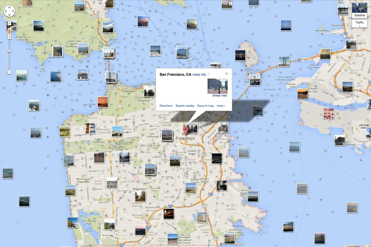
Navigation and mapping: Geotagging forms the foundation of navigation and mapping services like Google Maps or Apple Maps. By utilizing geotagged data, these services provide accurate directions, real-time traffic updates, and information about nearby points of interest. Geotagging allows users to navigate and explore both familiar and unfamiliar areas with ease.
Proximity-based notifications: Geotagging enables businesses to send targeted notifications or advertisements to users when they are in close proximity to their physical stores or establishments. Users can receive special offers, discounts, or information about events happening nearby, enhancing their overall experience and encouraging them to visit the suggested locations.
Location-based analytics: Geotagging data is valuable for businesses as it provides insights into consumer behavior, preferences, and trends in specific locations. With geotagged data, businesses can identify customer demographics, understand foot traffic patterns, and optimize their marketing strategies based on location-based analytics.
Geofencing: Geotagging is used to create virtual boundaries or geofences around specific locations. This allows businesses or applications to trigger certain actions or notifications when users enter or exit these predefined areas. Geofencing is commonly employed in location-based marketing, security systems, and personal safety applications.
Emergency services: Geotagging is crucial for emergency services to quickly locate individuals in need of assistance during emergencies or distress situations. By geotagging emergency calls, responders can pinpoint the exact location of the emergency, ensuring a faster and more effective response.
Personalized recommendations: Geotagging is used to provide personalized recommendations and customized experiences to users based on their location. For example, location-based recommendation systems can suggest nearby restaurants, hotels, or attractions based on user preferences and previous interactions.
Logistics and asset tracking: Geotagging enables businesses to track and manage assets, goods, or vehicles in real-time. By tagging assets with location data, businesses can monitor their movement, optimize delivery routes, and enhance supply chain management.
These are just a few examples of how geotagging is integrated into location-based services. By leveraging geotagging data, businesses can personalize services, improve operations, and deliver relevant content and experiences to users based on their specific location and interests.
Benefits of Geotagging
Geotagging offers numerous benefits in various aspects of digital experiences, providing value to individuals, businesses, and organizations. Here are some key benefits of geotagging:
Location context: Geotagging provides valuable location context to media files, such as photos, videos, or social media posts. This allows users to easily recall, organize, and search for content based on specific geographic locations. Geotagging enhances the significance and storytelling potential of media by adding a geographical dimension.
Enhanced searchability: Geotagging improves the searchability of content, making it easier for users to find information or media associated with specific locations. Whether searching for nearby restaurants, tourist attractions, or user-generated content in a particular area, geotagging can prioritize relevant results and improve the accuracy of search queries.
Geospatial analysis: Geotagging data enables businesses and organizations to perform geospatial analysis, uncovering valuable insights and trends related to specific locations. By analyzing geotagged content, they can gain a better understanding of consumer behavior, preferences, and market dynamics in different regions, helping to inform strategic decision-making and marketing strategies.
Personalization and recommendations: Geotagging allows for personalized experiences and targeted recommendations based on a user’s location. Businesses can leverage geotagged data to provide tailored offers, suggestions, or notifications to users based on their proximity to certain locations. This improves user engagement and increases the relevance of the content or offers delivered.
Exploration and discovery: Geotagging opens up a world of exploration and discovery, enabling users to find new places, attractions, or experiences based on their interests and location. Geotagged content allows individuals to navigate unfamiliar areas or gain inspiration for their next adventure, whether it’s planning a vacation, finding hidden gems, or exploring local cultural landmarks.
Operational optimization: Geotagging can help streamline business operations by providing location-based data for logistics, fleet management, or asset tracking. By tagging assets or vehicles with location data, businesses can optimize routes, track deliveries, and manage inventory more efficiently, improving overall operational performance and reducing costs.
Citizen engagement and civic planning: Geotagging can empower citizens to contribute to civic planning, community initiatives, or environmental monitoring. People can geotag images or data related to infrastructure issues, public services, or environmental concerns. This provides valuable information for decision-makers and helps raise awareness about local issues that require attention.
Privacy Concerns with Geotagging
While geotagging offers many benefits, it also raises valid privacy concerns due to the potential risks associated with sharing location data. Here are some privacy concerns to consider:
Location tracking: Geotagging can reveal a user’s precise location at a given time. This information can be misused to track someone’s movements without their knowledge or consent. Individuals may be concerned about their privacy and safety if their whereabouts are easily accessible to others.
Data security: Geotagging involves storing and sharing personal location data. If this data falls into the wrong hands, it could be used for malicious purposes, such as stalking or burglary. Protecting geotagged data through secure encryption and privacy measures is crucial to safeguard personal information.
Unintentional disclosure of private information: Geotagging can inadvertently disclose private information, such as home addresses, workplaces, or frequented locations. Users may not realize that they have shared too much information within their geotagged media, potentially compromising their privacy and security.
Social media risks: Geotagging on social media platforms can expose users to risks associated with oversharing. Broadcasting real-time location information can make individuals vulnerable to physical risks, such as stalking or theft, as well as cyber risks, including identity theft or social engineering attacks.
Unwanted targeting: Geotagged data can be exploited for targeted advertising or unwanted solicitations. Advertisers or third-party entities may use location information to identify individuals for marketing or sales purposes without their permission, leading to potential intrusions and privacy infringements.
Inadvertent sharing of sensitive locations: Geotagging can inadvertently expose sensitive locations, such as healthcare facilities, places of worship, or private properties. This unintentional exposure could compromise the privacy of individuals accessing these locations or disrupt the security of sensitive installations.
Lack of user control: Users may have limited control over how their geotagged data is used or shared by platforms or applications. Data might be shared with third-party entities or used for targeted advertising, without explicit consent or understanding of the data’s potential implications.
Considering these privacy concerns, it is important for users to be cautious when enabling geotagging features and understand the potential risks associated with sharing their location data. It is advisable to review and adjust privacy settings, use geotagging selectively, and remain vigilant about the implications of sharing location information in different contexts.
Best Practices for Geotagging
Geotagging can be a useful and fun feature when used responsibly. To ensure privacy, safety, and optimal use of geotagging, consider the following best practices:
Be mindful of what you share: Before geotagging photos or posts, be mindful of the content you are sharing and the potential implications of revealing your location. Consider whether the information could compromise your privacy or security.
Review privacy settings: Take the time to review and understand the privacy settings of the platforms or applications you use for geotagging. Adjust the settings to ensure that your location data is shared only with trusted individuals or in a manner that aligns with your comfort level.
Geotag selectively: Geotag photos and posts selectively rather than tagging every piece of content you share. Only geotag when it adds value to the content or serves a purpose. This reduces the likelihood of inadvertently sharing sensitive or private locations.
Consider delay or generalized geotagging: If privacy is a concern, consider using features that introduce a delay or generalize the location information in the geotags. This can add an additional layer of protection by providing a degree of anonymity or obfuscation.
Disable geotagging for sensitive locations: Be cautious about geotagging when it comes to sensitive locations like your home, workplace, or places where you regularly spend time. Disable geotagging for these specific locations to mitigate potential risks associated with sharing your exact whereabouts.
Regularly review tagged content: Periodically review your geotagged content on social media platforms and other online services. Remove or adjust the geotags if they are no longer necessary or if you have concerns about their visibility or implications.
Understand terms of service and data sharing: Familiarize yourself with the terms of service or privacy policies of platforms and applications you use for geotagging. Understand how your data is collected, stored, and shared. Only use platforms that prioritize user privacy and have clear data protection measures in place.
Educate yourself about risks and precautions: Stay informed about best practices and updates regarding geotagging. Educate yourself about the potential risks, such as location tracking or unwanted targeting. Stay updated on security measures and be proactive in implementing precautions to protect your privacy.
By following these best practices, you can enjoy the benefits of geotagging while ensuring your privacy and security are safeguarded. Remember that responsible geotagging involves making informed decisions about when and how to share your location data to avoid unintended consequences.
Tools and Apps for Geotagging
Geotagging has become increasingly popular, and several tools and apps are available to help users conveniently add location data to their photos, videos, or social media posts. Here are some notable tools and apps for geotagging:
Camera and smartphone settings: Many cameras and smartphones have built-in geotagging capabilities. By enabling location services in the device settings, the GPS coordinates of the capture location can be automatically embedded in the metadata of the photos or videos.
Geotagging software and applications: Various software applications are available that allow users to geotag images taken on devices without built-in GPS. These applications use methods like manually inputting the location data or matching photos to specific points on a map to add geotags. Examples of such software include GeoSetter, HoudahGeo, and Adobe Lightroom.
Geo-editing apps: Some apps focus specifically on editing geotags in existing photos. These apps allow users to add, edit, or remove geotags from their photos and videos. One popular example is Geotag Photos Pro, which is available for both iOS and Android devices.
Social media platforms: Many social media platforms, such as Instagram and Facebook, have integrated geotagging features. These platforms allow users to add location tags to their posts, providing a seamless way to share geotagged content with friends, followers, and wider online communities.
Navigation and mapping apps: Navigation apps like Google Maps, Apple Maps, or Waze utilize geotagging to provide real-time navigation, directions, and traffic updates. While these apps primarily focus on navigation, they can also be used to explore and discover nearby points of interest based on location data.
Online photo-sharing platforms: Platforms like Flickr and 500px provide geotagging features that allow users to add location data to their uploaded photos. These platforms often include interactive maps that display the geotagged photos, providing a visual exploration of images taken in specific locations.
Location-based social apps: Location-based social apps, such as Foursquare or Swarm, offer check-in features that enable users to share their current locations with friends and followers. These apps foster real-time location-based interactions and recommendations, encouraging users to explore and engage in social activities.
Outdoor tracking devices: For outdoor enthusiasts, devices like handheld GPS units, fitness trackers, or smartwatches often include geotagging capabilities. These devices allow users to accurately track routes, mark waypoints, and record geotagged data during outdoor activities.
These are just a few examples of the tools and apps available for geotagging. When choosing a tool or app for geotagging, consider your specific needs, the desired level of convenience, and the features that align with your intended use of geotagging.